During the construction of buildings (structures) or inthe time of the reconstruction work it is necessary to obtain permission for building or redevelopment. Moreover, besides the application, a scheme of the planning organization of the land plot should be provided (hereinafter referred to as SPOZU). In this article you will be able to find out what kind of project it is, what objects it should contain and the observance of what conditions guarantees the correctness of its preparation.

Development of a plan
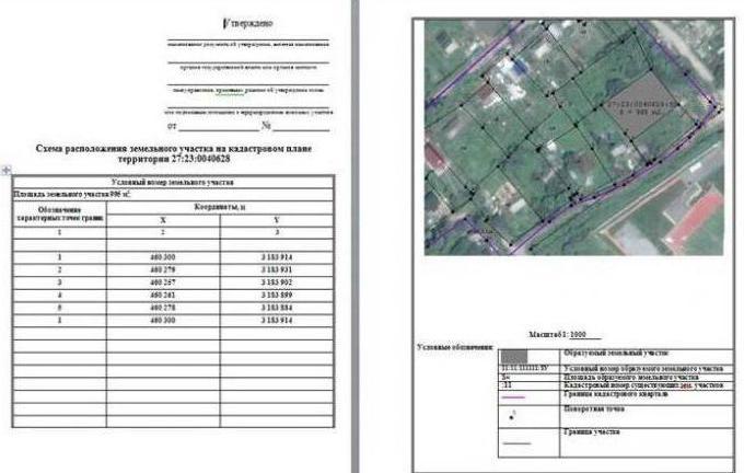
Not so long ago for the construction of residential buildings needwas to create a general construction project. Currently, he was replaced by a planning scheme of the land plot. Simply put, this is a plan for placing on the territory of newly created or already existing facilities, including communications. The presented scheme of the planning organization of the site is formed on the basis of the survey data. The document indicates the boundaries of the backyard area, existing buildings and, accordingly, the buildings of the future construction. The plan must be executed on a scale of 1: 500.
Structure of the project for IZhS
In case of individual housing construction, the planning organization scheme must necessarily include the following items:
- plan number;
- the number of floors indicating the height of the structure;
- percent of building with the indication of calculations;
- land area and residential building;
- type of fence;
- object structure;
- conventions.

Obligatory elements in the SPOZU for individuals
The scheme of the planning organization of a land plot for individual, private construction (for example, during the construction of a residential building) consists of 2 parts: textual and graphic.
The first paragraph includes the following nuances:
- the characteristics of the site where construction work will be carried out;
- confirmation of the features of sanitary protection zones within the boundaries of the estate (required only when it is necessary to establish these territories in accordance with Russian legislation);
- justification of land ownership planning in accordance with technical and town planning standards;
- landscaping project.

In the graphic part of the plan should be displayed:
- the area of the existing and newly created construction objects with the obligatory indication of the planned approaches and entrances;
- boundaries of sanitary breaks and protected areas;
- conclusion about the improvement of the garden plot.
SPOSA for legal entities
Scheme of land planning organizationsite for organizations of both commercial and non-commercial nature is only one of the 12 sections of the design documentation. In addition to this project, the types and a complete list of the objects of the planned construction should be indicated (regardless of the purpose of the erected structures).
List of documents for the project of capital construction
Planning plot includes a text part. It contains the following elements:
- the characteristic of household possession on which construction of object is planned;
- justification of the boundaries of sanitary gaps and protected areas within the site;
- confirmation of the planning of the constructed area in relation to the standards of urban planning and technical nature;
- technical and economic data of the area, which is used for the location of the constructed objects;
- description of decisions made on engineering development of territories, including the nuances of protecting buildings and structures from the possible consequences of geological impacts;

- conclusion on works on improvement of the built-up zone;
- distribution of construction objects with the justification and indication of the location of buildings of industrial and non-industrial significance, as well as all communications;
- reasoned reinforcement of technical indicators and characteristics of the used transport message.
Required drawings
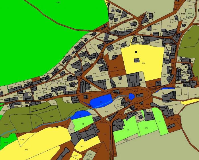
Scheme of planning organization of the land plot in the graphic part should contain:
- a depiction of ownership indicating the area of location of newly constructed and already existing objects, approaches and approaches to them;
- mapping zones of public servitudes, as well as buildings to be demolished (if any);
- documenting the decision taken regarding the design work, improvement, lighting and landscaping of the terrain used;
- justification of the stages of construction of buildings and structures of both production and non-production nature;
- drawing of the movement of vehicles on the construction site;
- a schematic representation of engineering networks (including the indication of the points of connection of the object being erected to these lines);
- earth mass project;

- accurate layout planurban planning within the built-up area, as well as a careful indication of the location of nearby and adjacent settlements to the borders of the developed territory; in addition, the areas with special conditions of use are defined and plotted on the scheme of areas that have a high risk of occurrence of dangerous natural and man-made situations;
- mapping the intended communications engineering andtransport character with the exact indication of their points of connection to existing networks. It is worth considering the moment that these systems can be used only for objects of production value.


